Our recent work on examining how people describe locations during natural disasters has been accepted as a full paper in the flagship GIScience conference. Due to COVID-19, this year’s conference is canceled; however, it is postponed to the next year, so it becomes GIScience 2021 🙂
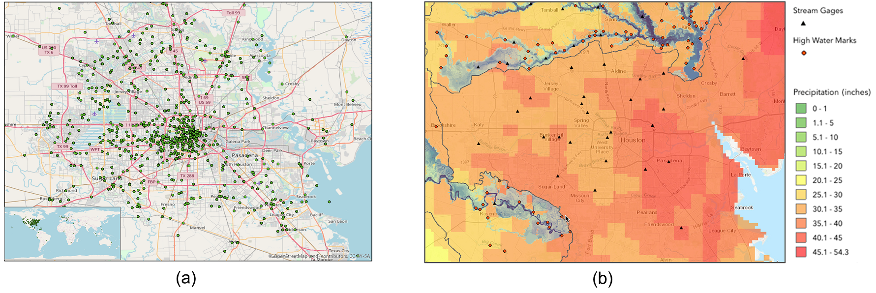
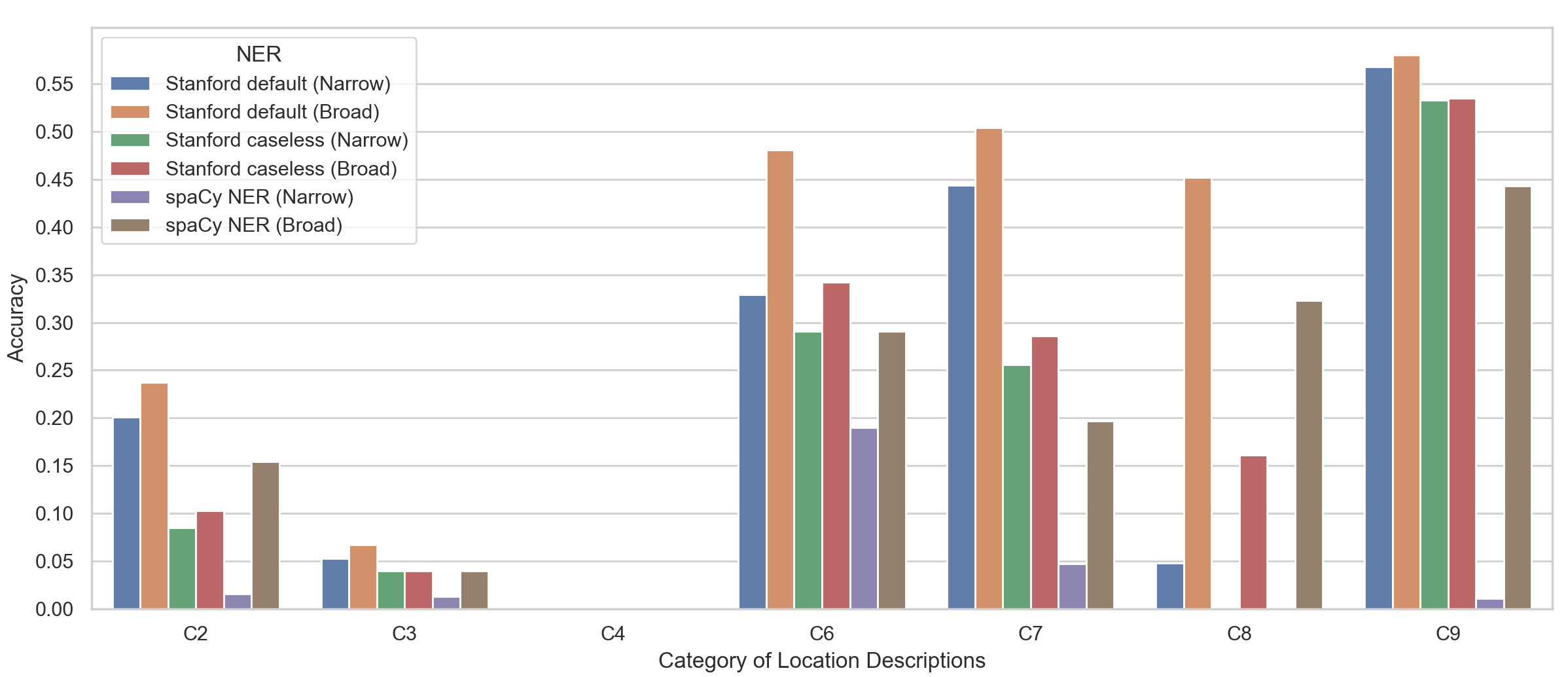
Abstract: Social media platforms, such as Twitter, have been increasingly used by people during natural disasters to share information and request for help. Hurricane Harvey was a category 4 hurricane that devastated Houston, Texas, USA in August 2017 and caused catastrophic flooding in the Houston metropolitan area. Hurricane Harvey also witnessed the widespread use of social media by the general public in response to this major disaster, and geographic locations are key information pieces described in many of the social media messages. A geoparsing system, or a geoparser, can be utilized to automatically extract and locate the described locations, which can help first responders reach the people in need. While a number of geoparsers have already been developed, it is unclear how effective they are in recognizing and geo-locating the locations described by people during natural disasters. To fill this gap, this work seeks to understand how people describe locations during a natural disaster by analyzing a sample of tweets posted during Hurricane Harvey. We then identify the limitations of existing geoparsers in processing these tweets, and discuss possible approaches to overcoming these limitations.
Full paper: Hu, Y. & Wang, J. (2020): How do people describe locations during a natural disaster: an analysis of tweets from Hurricane Harvey, In: Proceedings of the 11th International Conference on Geographic Information Science (GIScience 2021), Sep. 27-30, Poznan, Poland. [PDF]