Our new paper on “Aligning geographic entities from historical maps for building knowledge graphs” is accepted in the International Journal of Geographical Information Science.
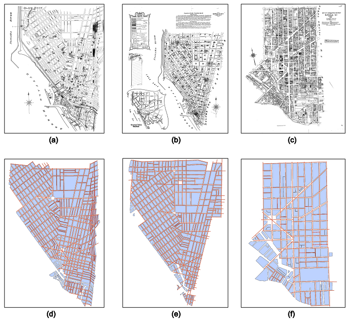
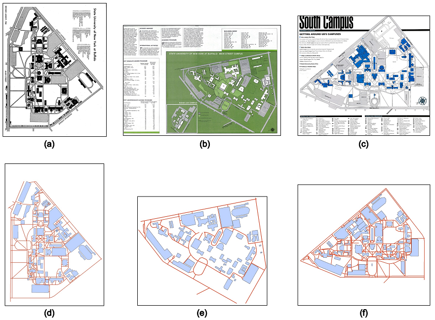
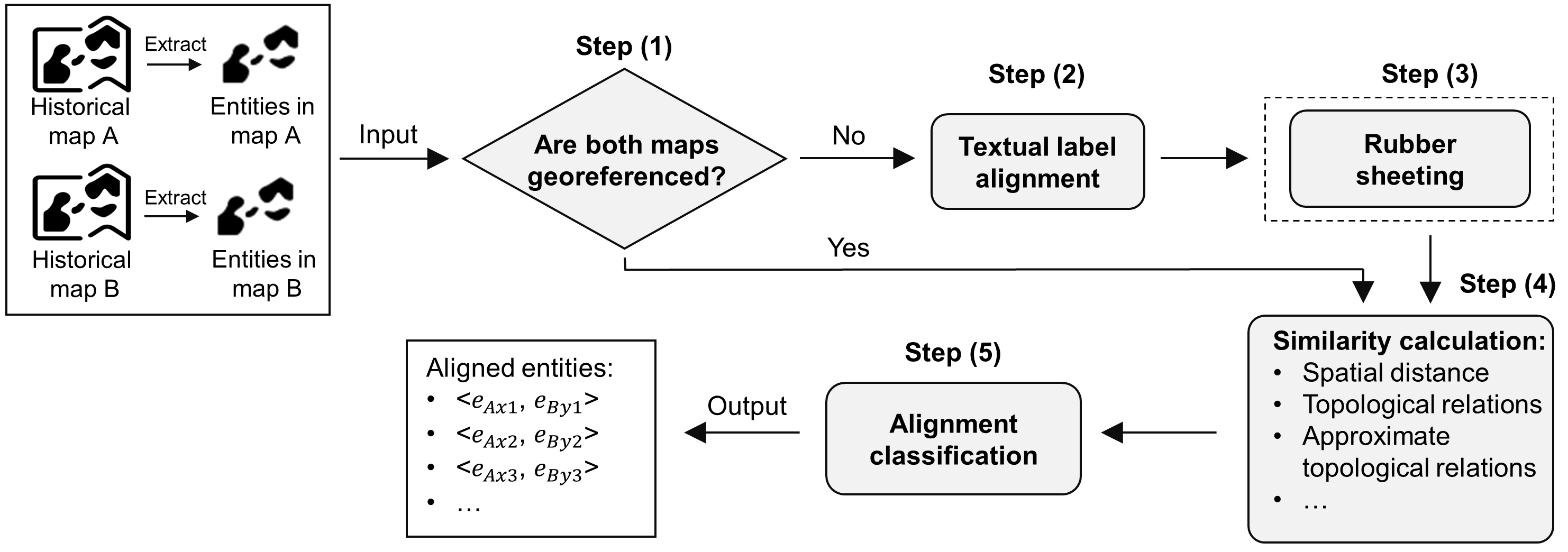
Historical maps contain rich geographic information about the past of a region. They are sometimes the only source of information before the availability of digital maps. Despite their valuable content, it is often challenging to access and use the information in historical maps, due to their forms of paper-based maps or scanned images. It is even more time-consuming and labor-intensive to conduct an analysis that requires a synthesis of the information from multiple historical maps. To facilitate the use of the geographic information contained in historical maps, one way is to build a geographic knowledge graph (GKG) from them. This paper proposes a general workflow for completing one important step of building such a GKG, namely aligning the same geographic entities from different maps. We present this workflow and the related methods for implementation, and systematically evaluate their performances using two different datasets of historical maps. The evaluation results show that machine learning and deep learning models for matching place names are sensitive to the thresholds learned from the training data, and a combination of measures based on string similarity, spatial distance, and approximate topological relation achieves the best performance with an average F-score of 0.89.
For more information, please refer to our full paper:
Kai Sun, Yingjie Hu, Jia Song, and Yunqiang Zhu (2020): Aligning geographic entities from historical maps for building knowledge graphs. International Journal of Geographical Information Science, in press.