Dr. Hu was invited to serve as an Academic Editor of PLOS ONE. PLOS ONE is a multidisciplinary and open access journal. Yingjie looks forward to contributing to editing submissions that leverage geospatial data, AI techniques, and spatial analysis to answer scientific questions.
Posts
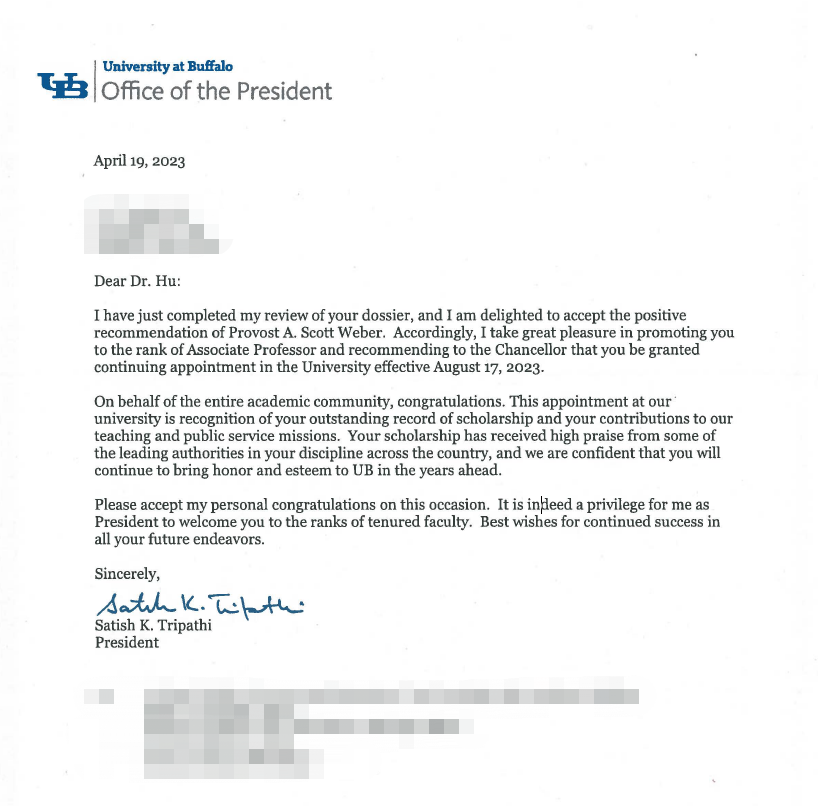
Dr. Hu receives UB Exceptional Scholar: Young Investigator Award
Dr. Hu receives the UB Exceptional Scholar: Young Investigator Award. This is the highest honor awarded to Assistant Professors at UB, which “celebrates a recent superior achievement of a scholar in his/her field of study”. Congratulations!
GeoAI Lab welcomes new lab member Aleema Arastu!
Aleema joins our lab as a master student. She previously completed her undergraduate studies at the University at Buffalo, receiving a B.S. in Geographic Information Science as well as a B.A. in International Studies with a focus on Asia and a minor in Korean language and culture. Before her undergraduate studies, she received certification in veterinary science. She is interested in applications of GIS to climate science, ecosystem biodiversity, and sustainable communities. Welcome, Aleema!
New paper on points of interest (POI) data is published in the journal Computational Urban Science
Abstract: In this commentary article, we describe the current state of the art of points of interest (POIs) as digital, spatial datasets, both in terms of their quality and affordings, and how they are used across research domains. We argue that good spatial coverage and high-quality POI features — especially POI category and temporality information — are key for creating reliable data. We list challenges in POI geolocation and spatial representation, data fidelity, and POI attributes, and address how these challenges may affect the results of geospatial analyses of the built environment for applications in public health, urban planning, sustainable development, mobility, community studies, and sociology. This commentary is intended to shed more light on the importance of POIs both as standalone spatial datasets and as input to geospatial analyses.
More details are available at: Achilleas Psyllidis, Song Gao, Yingjie Hu, Eun-Kyeong Kim, Grant McKenzie, Ross Purves, May Yuan, and Clio Andris (2022): Points of Interest (POI): a commentary on the state of the art, challenges, and prospects for the future. Computational Urban Science, 2(1), 1-13. [PDF]
Lab member Ryan Zhou receives a new NSF Research Experience for Graduates (REG) Award to study community resilience during natural disasters
Lab member Ryan Zhou receives a new NSF Research Experience for Graduates (REG) Award to study community resilience. He will work with Dr. Hu to examine human mobility changes and social media activities during natural disasters, such as the 2021 Texas winter storm. Congratulations Ryan!
New paper on the role of alcohol outlet visits derived from mobile phone location data in enhancing domestic violence prediction published in Health & Place
Domestic violence (DV) is a serious public health issue, with 1 in 3 women and 1 in 4 men experiencing some form of partner-related violence every year. Existing research has shown a strong association between alcohol use and DV at the individual level. Accordingly, alcohol use could also be a predictor for DV at the neighborhood level, helping identify the neighborhoods where DV is more likely to happen. However, it is difficult and costly to collect data that can represent neighborhood-level alcohol use especially for a large geographic area. In this study, we propose to derive information about the alcohol outlet visits of the residents of different neighborhoods from anonymized mobile phone location data, and investigate whether the derived visits can help better predict DV at the neighborhood level. We use mobile phone data from the company SafeGraph, which is freely available to researchers and which contains information about how people visit various points-of-interest including alcohol outlets. In such data, a visit to an alcohol outlet is identified based on the GPS point location of the mobile phone and the building footprint (a polygon) of the alcohol outlet. We present our method for deriving neighborhood-level alcohol outlet visits, and experiment with four different statistical and machine learning models to investigate the role of the derived visits in enhancing DV prediction based on an empirical dataset about DV in Chicago. Our results reveal the effectiveness of the derived alcohol outlets visits in helping identify neighborhoods that are more likely to suffer from DV, and can inform policies related to DV intervention and alcohol outlet licensing.
More details are available in the full paper at:
Ting Chang, Yingjie Hu, Dane Taylor, and Brian Quigley (2022): The role of alcohol outlet visits derived from mobile phone location data in enhancing domestic violence prediction at the neighborhood level. Health & Place, 73, 102736. [PDF]
New paper on using human mobility data and machine learning for studying alcohol sales and alcohol outlet visits during the early months of COVID-19 published in PLOS ONE
As many U.S. states implemented stay-at-home orders beginning in March 2020, anecdotes reported a surge in alcohol sales, raising concerns about increased alcohol use and associated ills. The surveillance report from the U.S. National Institute on Alcohol Abuse and Alcoholism provides data about the monthly alcohol sales in a subset of states, allowing an investigation of this potential increase in alcohol use. Meanwhile, anonymized human mobility data released by companies such as SafeGraph enables an examination of the visiting behavior of people to various alcohol outlets such as bars and liquor stores. Leveraging these novel datasets, this study examines changes to alcohol sales and alcohol outlet visits during COVID-19 and their geographic differences in a subset of U.S. states. We find major increases in the sales of spirits and wine since March 2020, while the sales of beer decreased. We also find moderate increases in people’s visits to liquor stores, while their visits to bars and pubs substantially decreased. Noticing a significant correlation between alcohol sales and outlet visits, we use machine learning models to examine how that relation changed in the early months of COVID-19 and find evidence in some states for likely panic buying of spirits and wine. Large geographic differences exist across the examined states, with both major increases and decreases in alcohol sales and alcohol outlet visits.
More details are available in the full paper at:
Yingjie Hu, Brian Quigley, and Dane Taylor (2021): Human mobility data and machine learning reveal geographic differences in alcohol sales and alcohol outlet visits across US states during COVID-19. PlOS ONE, 16(12), p.e0255757. [PDF]
This work was also covered in a number of media reports, including:
- CNN: We really did buy more alcohol during the early pandemic, study finds
- NPR-WBFO: UB study of 16 states confirms, yup, we drank a lot more last year
- Miami Herald: Americans stocked up on alcohol early during COVID, study finds. What did they buy?
- LMTOnline: Study shows COVID-19 impact on booze habits, TX bought more beer
- Thrillist: Americans Did Indeed Buy More Alcohol During the Pandemic
- New Medical: UB researchers analyze pandemic-related shifts in alcohol sales across 16 U.S. states
Merry Christmas and Happy New Year for 2022
While a lot of challenges and uncertainty continued in 2021, everyone in the world has been working hard and playing their roles to keep things functioning and to help us get back to a life without virus. Let’s hope for a better new year with all promises!
We wish you a Merry Christmas and a happy and healthy 2022!
New paper on a review of location encoding for GeoAI accepted in the journal IJGIS
A common need for artificial intelligence models in the broader geoscience is to represent and encode various types of spatial data, such as points (e.g., points of interest), polylines (e.g., trajectories), polygons (e.g., administrative regions), graphs (e.g., transportation networks), or rasters (e.g., remote sensing images), in a hidden embedding space so that they can be readily incorporated into deep learning models. One fundamental step is to encode a single point location into an embedding space, such that this embedding is learning-friendly for downstream machine learning models such as support vector machines and neural networks. We call this process location encoding. However, there lacks a systematic review on the concept of location encoding, its potential applications, and key challenges that need to be addressed. This paper aims to fill this gap. We first provide a formal definition of location encoding, and discuss the necessity of location encoding for GeoAI research from a machine learning perspective. Next, we provide a comprehensive survey and discussion about the current landscape of location encoding research. We classify location encoding models into different categories based on their inputs and encoding methods, and compare them based on whether they are parametric, multi-scale, distance preserving, and direction aware. We demonstrate that existing location encoding models can be unified under a shared formulation framework. We also discuss the application of location encoding for different types of spatial data.
More details are available in our paper at:
Gengchen Mai, Krzysztof Janowicz, Yingjie Hu, Song Gao, Bo Yan, Rui Zhu, Ling Cai, and Ni Lao (2021): A review of location encoding for GeoAI: methods and application. International Journal of Geographical Information Science, in press. [PDF]
New paper on a deep learning approach with GIS-based data augmentation for enriching the metadata of map images published in IJGIS
Maps in the form of digital images are widely available in geoportals, Web pages, and other data sources. The metadata of map images, such as spatial extents and place names, are critical for their indexing and searching. However, many map images have either mismatched metadata or no metadata at all. Recent developments in deep learning offer new possibilities for enriching the metadata of map images via image-based information extraction. One major challenge of using deep learning models is that they often require large amounts of training data that have to be manually labeled. To address this challenge, this paper presents a deep learning approach with GIS-based data augmentation that can automatically generate labeled training map images from shapefiles using GIS operations. We utilize such an approach to enrich the metadata of map images by adding spatial extents and place names extracted from map images. We evaluate this GIS-based data augmentation approach by using it to train multiple deep learning models and testing them on two different datasets: a Web Map Service image dataset at the continental scale and an online map image dataset at the state scale. We then discuss the advantages and limitations of the proposed approach.
More details are available in our paper at:
Yingjie Hu, Zhipeng Gui, Jimin Wang, and Muxian Li (2021): Enriching the metadata of map images: a deep learning approach with GIS-based data augmentation. International Journal of Geographical Information Science, in press. [PDF]