A new paper led by graduate student Yue Ma on “Forecasting vegetation dynamics in an open ecosystem by integrating deep learning and environmental variables” is published in the International Journal of Applied Earth Observation and Geoinformation.
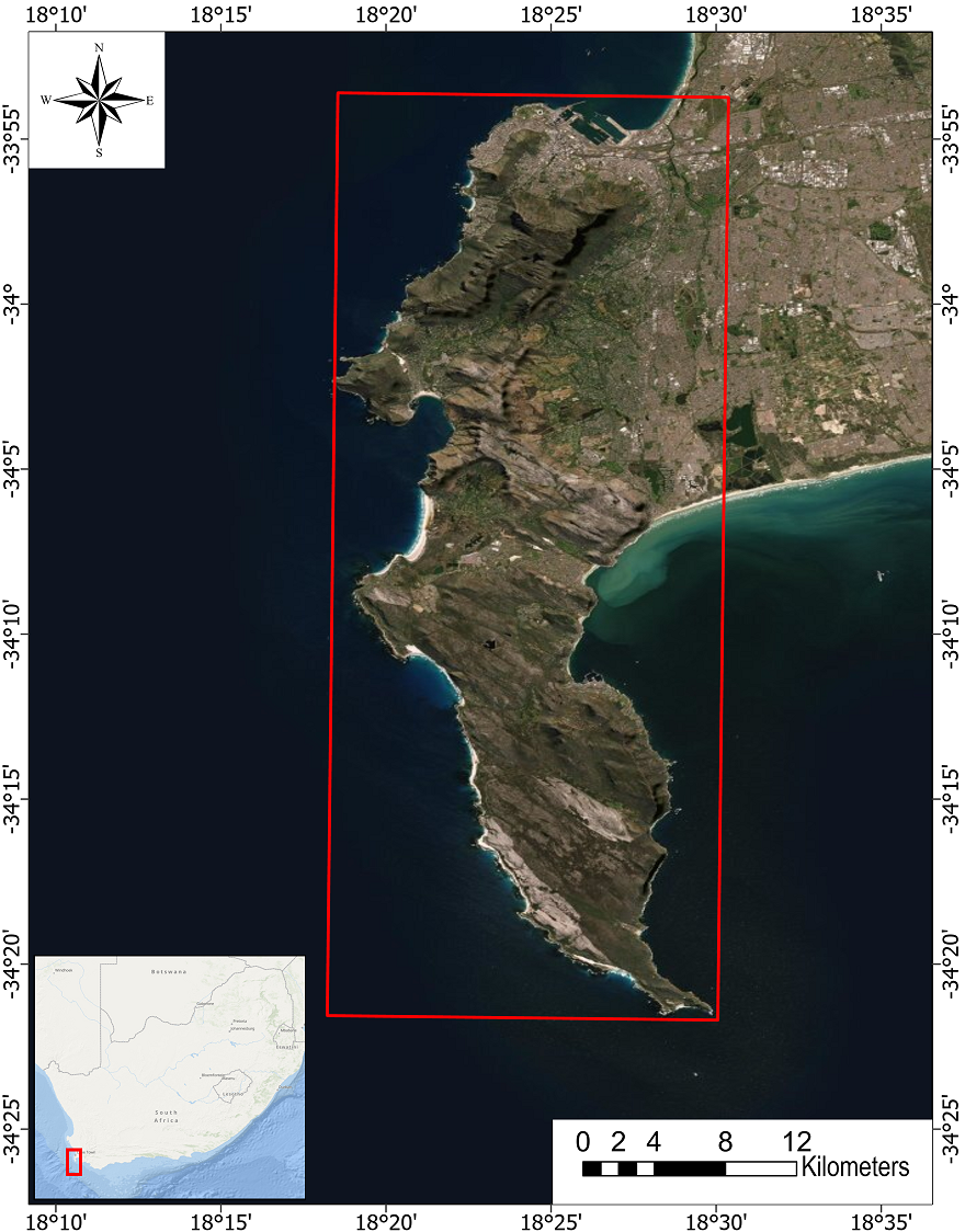
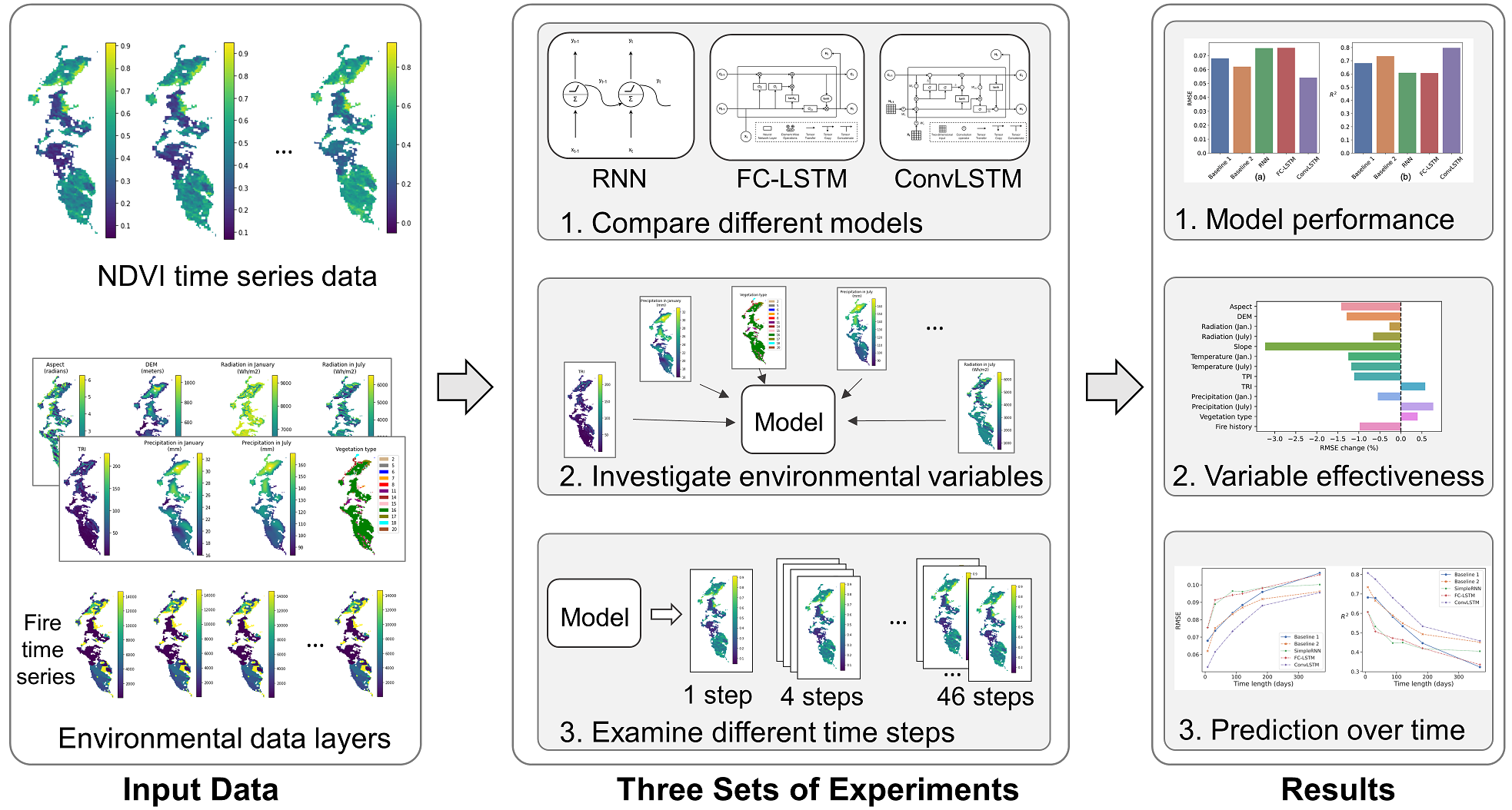
Abstract: Open (i.e., non-forest) ecosystems, such as savannas, shrublands, and grasslands, contain over 40 % of the global total ecosystem organic carbon and harbor a substantial portion of the world’s biodiversity. Accurately forecasting vegetation dynamics is critical for managing biodiversity, fire, water, and carbon in these open ecosystems. Unlike forests or other relatively stable ecosystems, open ecosystems can have dramatically changing vegetation states since they are prone to natural disturbances, long-term trends, and short-term events. Consequently, it is challenging to accurately predict vegetation state in this type of ecosystems. This paper investigates the use of deep learning based approaches for forecasting vegetation dynamics in an open ecosystem, the fynbos shrublands of the Cape Floristic Region of South Africa, a global biodiversity hotspot. We experiment with different deep learning models and examine the ability of thirteen environmental variables, such as precipitation, fire history, and temperature, to enhance the forecasting. We find that the ConvLSTM model can forecast vegetation state more accurately than four other compared baseline approaches. The environmental variable mean precipitation in July (winter) provides the most prominent enhancement for forecasting among the tested variables. Finally, we discuss the pros and cons of using a deep learning based approach for vegetation forecasting in open ecosystems from a conservation management perspective.
![]()
More details are available in: Yue Ma, Yingjie Hu, Glenn R Moncrieff, Jasper A Slingsby, Adam M Wilson, Brian Maitner, and Ryan Zhenqi Zhou (2022): Forecasting vegetation dynamics in an open ecosystem by integrating deep learning and environmental variables. International Journal of Applied Earth Observation and Geoinformation, 114, 103060. [PDF]