Welcome Dr. Kai Sun joining GeoAI Lab as a Postdoc Associate

We are excited to have Dr. Kai Sun come back and join our GeoAI Lab again! Previously, he was a visiting PhD student in our GeoAI Lab from 2019 to 2021. He obtained his B.S. from Wuhan University and his M.S. and Ph.D. from the Institute of Geographic Sciences and Natural Resources Research, Chinese Academy of Sciences. His current research focuses on using GeoAI approaches for advancing disaster management.

Welcome back, Kai!

New paper on deriving neighborhood-level diet and physical activity measurements from anonymized mobile phone location data for enhancing obesity estimation accepted in the International Journal of Health Geographics

Abstract:

Background: Obesity is a serious public health problem. Existing research has shown a strong association between obesity and an individual’s diet and physical activity. If we extend such an association to the neighborhood level, information about the diet and physical activity of the residents of a neighborhood may improve the estimate of neighborhood-level obesity prevalence and help identify the neighborhoods that are more likely to suffer from obesity. However, it is challenging to measure neighborhood-level diet and physical activity through surveys and interviews, especially for a large geographic area.

Methods: We propose a method for deriving neighborhood-level diet and physical activity measurements from anonymized mobile phone location data, and examine the extent to which the derived measurements can enhance obesity estimation, in addition to the socioeconomic and demographic variables typically used in the literature. We conduct case studies in three different U.S. cities, which are New York City, Los Angeles, and Buffalo, using anonymized mobile phone location data from the company SafeGraph. We employ five different statistical and machine learning models to test the potential enhancement brought by the derived measurements for obesity estimation.

Results: We find that it is feasible to derive neighborhood-level diet and physical activity measurements from anonymized mobile phone location data. The derived measurements provide only a small enhancement for obesity estimation, compared with using a comprehensive set of socioeconomic and demographic variables. However, using these derived measurements alone can achieve a moderate accuracy for obesity estimation, and they may provide a stronger enhancement when comprehensive socioeconomic and demographic data are not available (e.g., in some developing countries). From a methodological perspective, spatially explicit models overall perform better than non-spatial models for neighborhood-level obesity estimation.

Conclusions: Our proposed method can be used for deriving neighborhood-level diet and physical activity measurements from anonymized mobile phone data. The derived measurements can enhance obesity estimation, and can be especially useful when comprehensive socioeconomic and demographic data are not available. In addition, these derived measurements can be used to study obesity-related health behaviors, such as visit frequency of neighborhood residents to fast-food restaurants, and to identify primary places contributing to obesity-related issues.

Keywords: Obesity, diet, physical activity, anonymized mobile phone location data, GeoAI.

More details are available at: Ryan Zhenqi Zhou, Yingjie Hu, Jill Tirabassi, Yue Ma, and Zhen Xu (2022): Deriving neighborhood-level diet and physical activity measurements from anonymized mobile phone location data for enhancing obesity estimation. International Journal of Health Geographics, 21(1), 1-18. [PDF]

New paper on integrating deep learning and environmental variables for ecological forecasting published in the International Journal of Applied Earth Observation and Geoinformation

A new paper led by graduate student Yue Ma on “Forecasting vegetation dynamics in an open ecosystem by integrating deep learning and environmental variables” is published in the International Journal of Applied Earth Observation and Geoinformation.

Abstract: Open (i.e., non-forest) ecosystems, such as savannas, shrublands, and grasslands, contain over 40 % of the global total ecosystem organic carbon and harbor a substantial portion of the world’s biodiversity. Accurately forecasting vegetation dynamics is critical for managing biodiversity, fire, water, and carbon in these open ecosystems. Unlike forests or other relatively stable ecosystems, open ecosystems can have dramatically changing vegetation states since they are prone to natural disturbances, long-term trends, and short-term events. Consequently, it is challenging to accurately predict vegetation state in this type of ecosystems. This paper investigates the use of deep learning based approaches for forecasting vegetation dynamics in an open ecosystem, the fynbos shrublands of the Cape Floristic Region of South Africa, a global biodiversity hotspot. We experiment with different deep learning models and examine the ability of thirteen environmental variables, such as precipitation, fire history, and temperature, to enhance the forecasting. We find that the ConvLSTM model can forecast vegetation state more accurately than four other compared baseline approaches. The environmental variable mean precipitation in July (winter) provides the most prominent enhancement for forecasting among the tested variables. Finally, we discuss the pros and cons of using a deep learning based approach for vegetation forecasting in open ecosystems from a conservation management perspective.

More details are available in: Yue Ma, Yingjie Hu, Glenn R Moncrieff, Jasper A Slingsby, Adam M Wilson, Brian Maitner, and Ryan Zhenqi Zhou (2022): Forecasting vegetation dynamics in an open ecosystem by integrating deep learning and environmental variables. International Journal of Applied Earth Observation and Geoinformation, 114, 103060. [PDF]

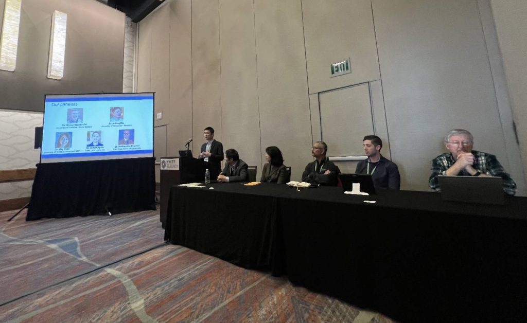
2023 AAG GeoAI Symposium: Call for Sessions

We are currently organizing the 2023 AAG GeoAI Symposium. If you are interested, please see the call for sessions below:

Call for Sessions: 2023 AAG Symposium on GeoAI and Deep Learning for Geospatial Research

AAG Annual Meeting, Denver, March 23-27, 2023

Lead Organizers:
Yingjie Hu, University at Buffalo (yhu42@buffalo.edu)
Song Gao, University of Wisconsin, Madison (song.gao@wisc.edu)
Wenwen Li, Arizona State University (wenwen@asu.edu)
Dalton Lunga, Oak Ridge National Laboratory (lungadd@ornl.gov)
Orhun Aydin, Saint Louis University (orhun.aydin@slu.edu)
Shawn Newsam, University of California, Merced (snewsam@ucmerced.edu)

The past few years have witnessed significant advances in the interdisciplinary field of GeoAI. With the increasing availability of geospatial big data, advances in hardware computing, and novel AI models, researchers have integrated these three to address some of the most challenging problems facing our society and deliver positive social impacts. Examples include improving individual and population health, enhancing community resilience in natural disasters, predicting spatiotemporal traffic flows, forecasting the impacts of climate change on ecosystems, building smart and connected communities and cities, and supporting humanitarian mapping and policymaking. From a perspective of method development, researchers have infused spatial principles into AI models, and developed spatially explicit AI models that can better address geospatial problems, such as enhancing geoprivacy protection and better representing geographic features in embedding space. Great research efforts have also been made to increase the explainability of GeoAI models for supporting decision making, and identify and reduce potential biases in training data and the trained models.

Building on the success of previous AAG GeoAI symposiums, the 2023 Symposium aims to bring together geographers, GI scientists, remote sensing scientists, computer scientists, health researchers, urban planners, transportation professionals, disaster response experts, ecologists, earth system scientists, stakeholders, and many others to share recent research outcomes and discuss challenges for GeoAI research in the following years. We are calling for sessions on all topics related to GeoAI, including but not limited to:

  • Advances in GeoAI methods and spatially explicit models
  • GeoAI for deriving novel measurements and statistics
  • GeoAI for enhancing community resilience in the face of disasters
  • Ethics, geoprivacy issues, and social implications in GeoAI research
  • GeoAI for improving individual and population health
  • GeoAI for urban analytics, social sensing, and smart communities
  • GeoAI for traffic flow predictions and transportation management
  • GeoAI for supporting precision agriculture
  • GeoAI for predicting the impact of climate change on communities
  • GeoAI for ecosystem conservation and biodiversity
  • GeoAI for earth system modeling and forecasting
  • GeoAI for crime analysis and public safety
  • Cyberinfrastructures and knowledge graphs for advancing GeoAI
  • Data resources, tools, and benchmarking platforms for GeoAI

Different types of sessions, such as Paper Session, Panel Session, and Lightning Talk Session, are all welcome. If you are interested in organizing a session in this symposium, please send an email to Yingjie Hu at yhu42@buffalo.edu before October 24, 2022. In your email, please indicate a working title of your session (which can be revised later), the session type (e.g., Paper Session or Panel Session), and session modality (whether it will be in-person or virtual). For any questions, please feel free to contact one of our organizers. Thank you and we look forward to seeing you in AAG 2023!

Best wishes,
Yingjie Hu, University at Buffalo (yhu42@buffalo.edu)
Song Gao, University of Wisconsin, Madison (song.gao@wisc.edu)
Wenwen Li, Arizona State University (wenwen@asu.edu)
Dalton Lunga, Oak Ridge National Laboratory (lungadd@ornl.gov)
Orhun Aydin, Saint Louis University (orhun.aydin@slu.edu)
Shawn Newsam, University of California, Merced (snewsam@ucmerced.edu)

GeoAI Lab welcomes new lab member Aleema Arastu!

GeoAI Lab welcomes new lab member Aleema Arastu!

Aleema joins our lab as a master student. She previously completed her undergraduate studies at the University at Buffalo, receiving a B.S. in Geographic Information Science as well as a B.A. in International Studies with a focus on Asia and a minor in Korean language and culture. Before her undergraduate studies, she received certification in veterinary science. She is interested in applications of GIS to climate science, ecosystem biodiversity, and sustainable communities. Welcome, Aleema!

New paper on points of interest (POI) data is published in the journal Computational Urban Science

Abstract: In this commentary article, we describe the current state of the art of points of interest (POIs) as digital, spatial datasets, both in terms of their quality and affordings, and how they are used across research domains. We argue that good spatial coverage and high-quality POI features — especially POI category and temporality information — are key for creating reliable data. We list challenges in POI geolocation and spatial representation, data fidelity, and POI attributes, and address how these challenges may affect the results of geospatial analyses of the built environment for applications in public health, urban planning, sustainable development, mobility, community studies, and sociology. This commentary is intended to shed more light on the importance of POIs both as standalone spatial datasets and as input to geospatial analyses.

More details are available at: Achilleas Psyllidis, Song Gao, Yingjie Hu, Eun-Kyeong Kim, Grant McKenzie, Ross Purves, May Yuan, and Clio Andris (2022): Points of Interest (POI): a commentary on the state of the art, challenges, and prospects for the future. Computational Urban Science, 2(1), 1-13. [PDF]

New paper on the role of alcohol outlet visits derived from mobile phone location data in enhancing domestic violence prediction published in Health & Place

Domestic violence (DV) is a serious public health issue, with 1 in 3 women and 1 in 4 men experiencing some form of partner-related violence every year. Existing research has shown a strong association between alcohol use and DV at the individual level. Accordingly, alcohol use could also be a predictor for DV at the neighborhood level, helping identify the neighborhoods where DV is more likely to happen. However, it is difficult and costly to collect data that can represent neighborhood-level alcohol use especially for a large geographic area. In this study, we propose to derive information about the alcohol outlet visits of the residents of different neighborhoods from anonymized mobile phone location data, and investigate whether the derived visits can help better predict DV at the neighborhood level. We use mobile phone data from the company SafeGraph, which is freely available to researchers and which contains information about how people visit various points-of-interest including alcohol outlets. In such data, a visit to an alcohol outlet is identified based on the GPS point location of the mobile phone and the building footprint (a polygon) of the alcohol outlet. We present our method for deriving neighborhood-level alcohol outlet visits, and experiment with four different statistical and machine learning models to investigate the role of the derived visits in enhancing DV prediction based on an empirical dataset about DV in Chicago. Our results reveal the effectiveness of the derived alcohol outlets visits in helping identify neighborhoods that are more likely to suffer from DV, and can inform policies related to DV intervention and alcohol outlet licensing.

More details are available in the full paper at:
Ting Chang, Yingjie Hu, Dane Taylor, and Brian Quigley (2022): The role of alcohol outlet visits derived from mobile phone location data in enhancing domestic violence prediction at the neighborhood level. Health & Place, 73, 102736. [PDF]